


Timothy Twp. Voting District, Crow Wing County, Minnesota
About
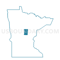
Outline

Summary
| Unique Area Identifier | 601682 |
| Name | Timothy Twp. Voting District |
| County | Crow Wing County |
| State | Minnesota |
| Area (square miles) | 35.64 |
| Land Area (square miles) | 34.37 |
| Water Area (square miles) | 1.27 |
| % of Land Area | 96.43 |
| % of Water Area | 3.57 |
| Latitude of the Internal Point | 46.75601500 |
| Longtitude of the Internal Point | -94.20256940 |
Maps


Graphs
Select a template below for downloading or customizing gragh for Timothy Twp. Voting District, Crow Wing County, Minnesota


Neighbors
Neighoring Voting District (by Name) Neighboring Voting District on the Map
- Blind Lake Twp. Voting District, Cass County, MN
- Crosslake P-1 Voting District, Crow Wing County, MN
- Fifty Lakes City Voting District, Crow Wing County, MN
- Gail Lake Twp. Voting District, Crow Wing County, MN
- Ideal Twp. Voting District, Crow Wing County, MN
- Jenkins Twp. Voting District, Crow Wing County, MN
- Manhattan Beach City Voting District, Crow Wing County, MN
- Ponto Lake Twp. Voting District, Cass County, MN
- Trelipe Twp. Voting District, Cass County, MN
Top 10 Neighboring County Subdivision (by Population) Neighboring County Subdivision on the Map
- Crosslake city, Crow Wing County, MN (2,141)
- Ideal township, Crow Wing County, MN (1,069)
- Ponto Lake township, Cass County, MN (481)
- Fifty Lakes city, Crow Wing County, MN (387)
- Jenkins township, Crow Wing County, MN (359)
- Timothy township, Crow Wing County, MN (162)
- Trelipe township, Cass County, MN (150)
- Gail Lake township, Crow Wing County, MN (97)
- Blind Lake township, Cass County, MN (82)
- Manhattan Beach city, Crow Wing County, MN (57)
Top 10 Neighboring Place (by Population) Neighboring Place on the Map
Top 10 Neighboring Unified School District (by Population) Neighboring Unified School District on the Map
- Pequot Lakes Public School District, MN (9,874)
- Pine River-Backus Public School District, MN (7,315)
- Northland Community Schools, MN (4,432)
Top 10 Neighboring State Legislative District Lower Chamber (by Population) Neighboring State Legislative District Lower Chamber on the Map
Top 10 Neighboring State Legislative District Upper Chamber (by Population) Neighboring State Legislative District Upper Chamber on the Map
Top 10 Neighboring 111th Congressional District (by Population) Neighboring 111th Congressional District on the Map
Top 10 Neighboring Census Tract (by Population) Neighboring Census Tract on the Map
- Census Tract 9517, Crow Wing County, MN (2,737)
- Census Tract 9602, Cass County, MN (2,305)
- Census Tract 9501, Crow Wing County, MN (1,985)